San Luis Potosí , San Luis Potosí, Mexico
November 13-14
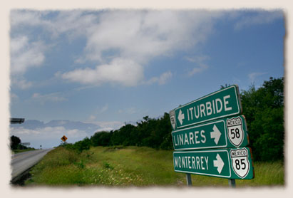
Our maps and the GPS called the road Highway 31, but all of the road signs said Highway 58. It's typical of the Mexico highway system, where roads share several numbers depending on where you are and roads with the same number can run parallel to each other or head in opposite directions. Highway 58 goes from Linares to San Roberto, connecting Highway 85 that hugs Mexico 's east coast to Highway 57 in the country's center. It was our first deviation off of the Pan American highway system.
| |
We stop to check the map again after seeing repeated signs marking the road as Highway 58 when the map and GPS identify it as Highway 31. |
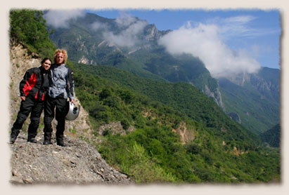
Soon after we turned off in Linares , we passed two motorcyclists who gave hearty waves. In 10 minutes we knew why. Highway 58 is 40 some odd miles of motorcycling paradise. It's also dangerous, with signs warning Curvas Peligrosas, dangerous curves. The two-lane paved road winds its way through the Sierra Madre Mountains . Each corner is a compromise between hugging the center line, which is often violated by approaching tractor trailers or tip toeing along an edge which drops off several hundred feet and is rarely protected by a guard rail. In some places rocks had fallen into the road or curves were rough and pot-holed. But traffic was light and the views stunning, with rugged pine tree covered nearly vertical peaks on both sides of the road and we flew past little logging towns and farms. The fully loaded Moto Guzzi handled remarkably well, like a horse that's spent too much time in a barn. Through the highest pass, our GPS told us that we'd gone from nearly sea-level at the border to 6,200 feet.
| |
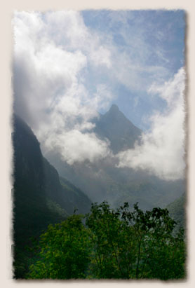
Clouds hung lower than many of the peaks of the Sierra Madre Mountains . |
| |
Holly and Jeremiah stop along Highway 58 through the Sierra Madres mountains on the way to San Roberto. |
As we approached San Roberto on the final straight-as-an-arrow five miles of Highway 58, the geography changed. The lush green coastal region turned into the dry and arid central highlands. Throughout the flat land, we could see dust devils rise from the fields like smoke. Soon after turning onto Highway 85, we stop for gas and this time, the attendants at the Pemex station are two young boys, barely tall enough to put the pump handle in the motorcycle tank.
| |
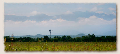
A lone windmill marks the property of farm land with the Sierra Madre Mountains looming in back. |
| |
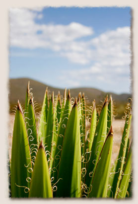
A native plant proves to be ornate close up at a Pemex gas station after we reached the arid land west of the mountains. |
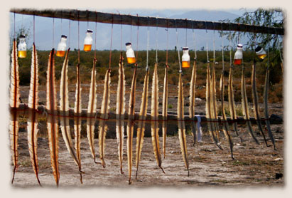
Though the land around the highway seemed uninhabitable, signs of life cropped up everywhere. The plains were flat except for the occasionally lumpy hill, the peaks of which were usually adorned with a cross. Sometimes, on impossibly steep slopes a foot path would meander up the side, disappearing as it crossed the summit. We approached an area of roadside stands that seemed to be holding feathers, blowing in the breeze. As we got near I could see that they were rattlesnake skins, drying in the sun. The stands, run by the local indigenous people, stretched for a mile, both sides of the road curtained in scaly brown.
| |
Rattlesnake skins hang out to dry along Interstate 85. |
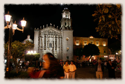
San Luis Potosí is a colonial town founded by the silver-seeking Spanish in 1592. An industrial city, we stayed in the central historic district at the Hotel Guadalajara, beside a plaza filled with mariachis. As we passed through the plaza at dusk, the singers and musicians sat, talking to each other, while a pickup truck blared mariachi music. Searching for a restaurant after dark, we wandered through the city's many plazas, each built around a cathedral. In one, an orchestra performed in a gazebo, playing Beatles covers with violins and cellos. The crowd filled the gazebo and into the streets and sidewalks.
| |
Plaza Carmen was alive with people Sunday night. The Templo de Carmen was lit and a small side show kept children entertained for hours. |
| |
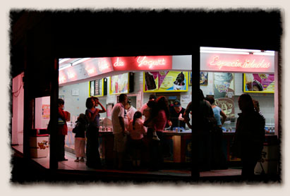
An ice cream stand called "Tucky Tucky" serves many flavors of helado de yogurt or frozen yogurt. |
| |
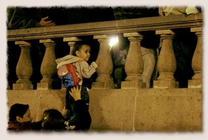
A mother holds up her child to see the live orchestra perform a medley of Beatles songs in San Luis Potosi . |
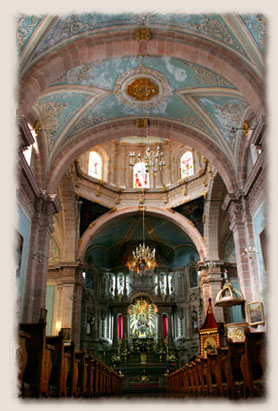
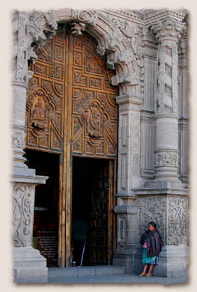
In the morning we wandered again, fascinated with the architectural buffet the city had to offer. The doors of the Templo San Francisco were open, and we cautiously ventured in. The beauty of the outside of the building was surpassed only by its interior with lavishly decorated walls and ceilings. Into the walls are built shrines for saints. The building was deserted at 9 a.m. in the morning, except for an elderly man who made his way around the church, stopping to pray at each shrine. We hung back, hoping that we wouldn't disturb him and embarrassed to be tourists in his spirituality.
| |
The Templo de San Francisco was built in the 17th century, its doors remain open to anyone wishing to venture in for a look. Inside, small rooms serve as shrines for saints and patrons come to pray at anytime during the day. |
| |
The 18th century Templo de Carmen. |
| |
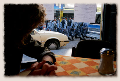
Monday morning during breakfast we saw a small parade of the local police force marching instep to the beat of a single drum. |
| |
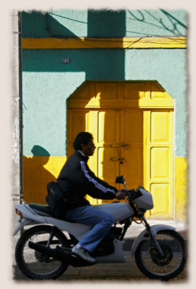
Un hombre putts by on una moto in San Luis Potosi. Many residents rode small motorcycles or scooters to get around town. |
|
|