Ojochal, Punta Arenas , Costa Rica
December 17-18
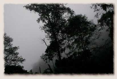
The road that leaves San José quickly climbs out of the central valley and into the Talamanca Mountains , known as the Cerros de Muertos or Hills of Death for their steep peaks and the twisty roads that cross them. As we traveled in the early morning hours the road was fog covered as it climbed above the clouds to 11,000 feet, our highest ride of the trip. The road was typical Costa Rican, covered with potholes that made traffic maneuver like Shriners' in a parade, and under construction. Every time we ground to a halt, I pulled as close to the edge of the road as possible and flashed my brake lights to warn those traveling behind us in the fog that traffic was stopped.
| |
Upon leaving San José , we had to cross over mountains that left us navigating through fog and clouds. |
As the road began to ascend to the coast we could catch occasional, teasing glimpses of the ocean in the distance through the trees. We had passed within 10 miles of the Pacific Ocean in Mexico , but didn't have time to stop. Now Holly and I were seeing it for the first time and knew that before nightfall we would be in the water.
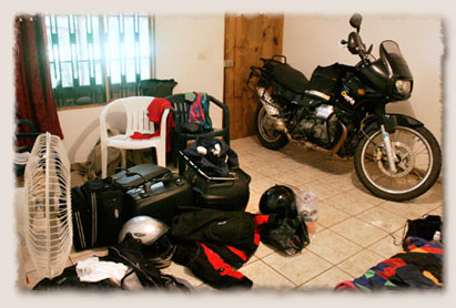
You turn off the Pan-American in a town called San Isidro for the final steep grade to the coast. We had planned to stay in the surfer town of Dominical , but decided instead to pass through and continue down the coast on a beautiful, two lane road that hugged the hills above the water's edge. We eventually stopped in Ojochal, not a town as much as a collection of gas stations and hotels, at a set of road side cabinas. Our room was large enough that we pulled the bike inside with us for the night.
| |
This was our goal at some point on the trip, to wheel the Guzzi inside our room. The bike slept soundly with us, safely inside and free of disc locks and cover. |

| |
Muscling bits of leaves, a colony of ants formed a causeway across the path leading to our hotel door. |
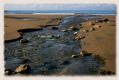
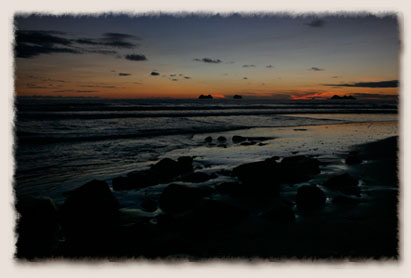
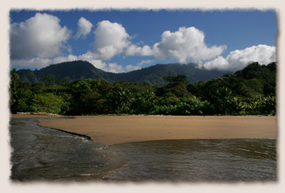
After unpacking, we made our way to the isolated Pacific beach, the path leading by a freshwater stream that ran from the mountains into the ocean. The shore near Ojochal is part of the Marino Ballena National Park . The sea shelf was shallow, with the water almost touching the coconut trees when the tide was in and exposing 100 yards of sand and rocks when it was out. The current is strong, but the waves break far out, keeping the surfing crowd farther up the coast. We swam out far enough that the water was above our heads, and looking back towards land, could see the Costa Rican mountains that run nearly into the sea. As darkness fell, we caught our first sunset over an ocean.
| |
A freshwater stream filters into the Pacific Ocean in Marino Ballena National Park. |
| |
This was the first time either of us had seen or touched the Pacific Ocean . The beach, with its brown sand and smooth stones, was very different from the Caribbean waters of Tulum. |
With a short ride ahead the next day, we woke early for another trip to the beach. At low tide the dark sand was covered in crabs and sea slugs and the rocks that form the coast were exposed and drying in the sun. We were back on the bike and on our way before the sun had cleared the mountains.
| |
The Costa Rican mountains come nearly to the water's edge at the Marino Ballena National Park. |
| |
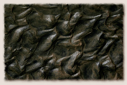
Sand and silt mix together where the freshwater stream meets the Pacific Ocean. |
|
|